
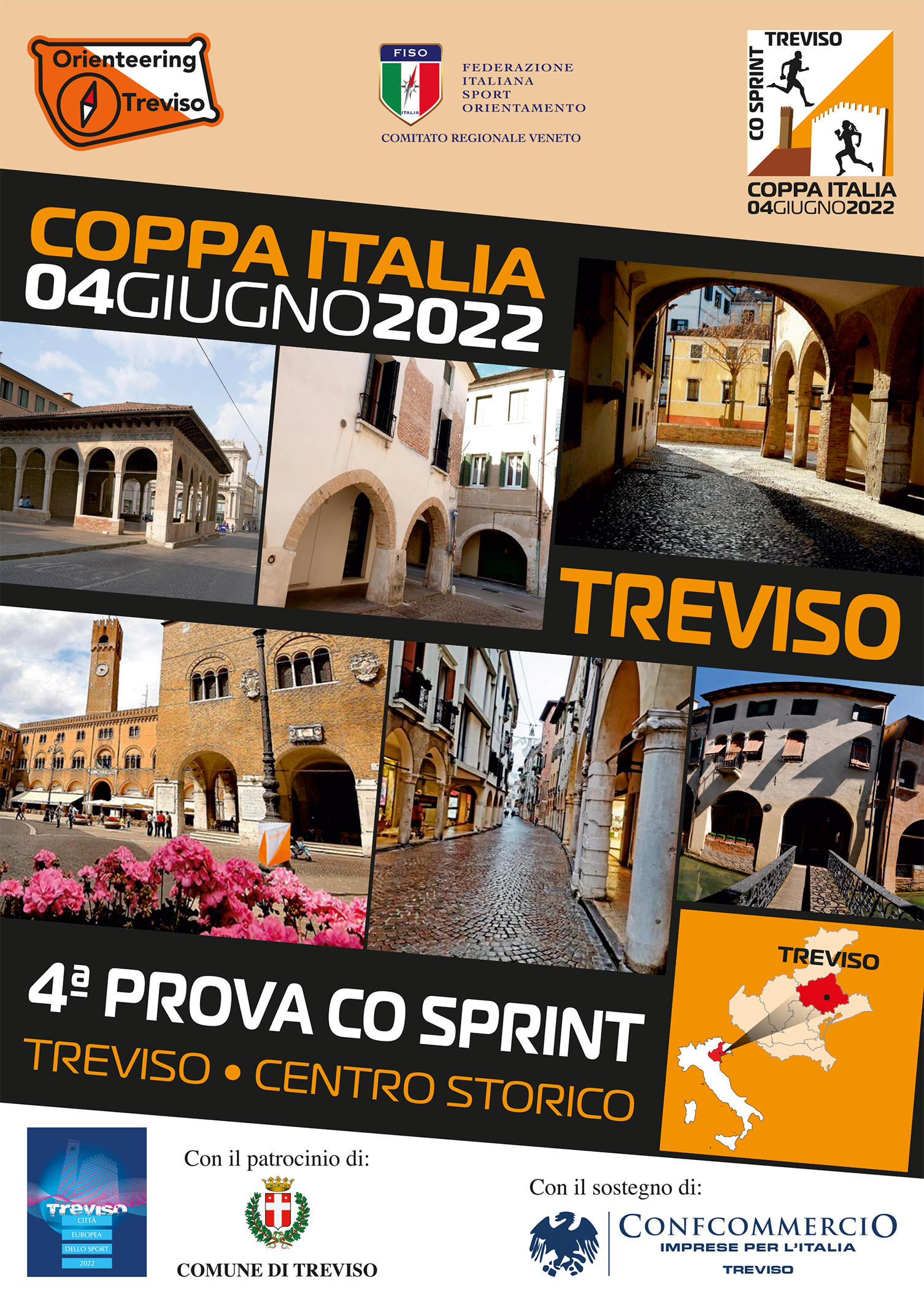
4th Trail Coppa Italia Sprint 2022
Treviso – June 4th 2022
RACE BULLETIN N. 2 – May 26th 2022
Integrates bulletin n. 1
This second bulletin contains new useful informations further to the previous one.
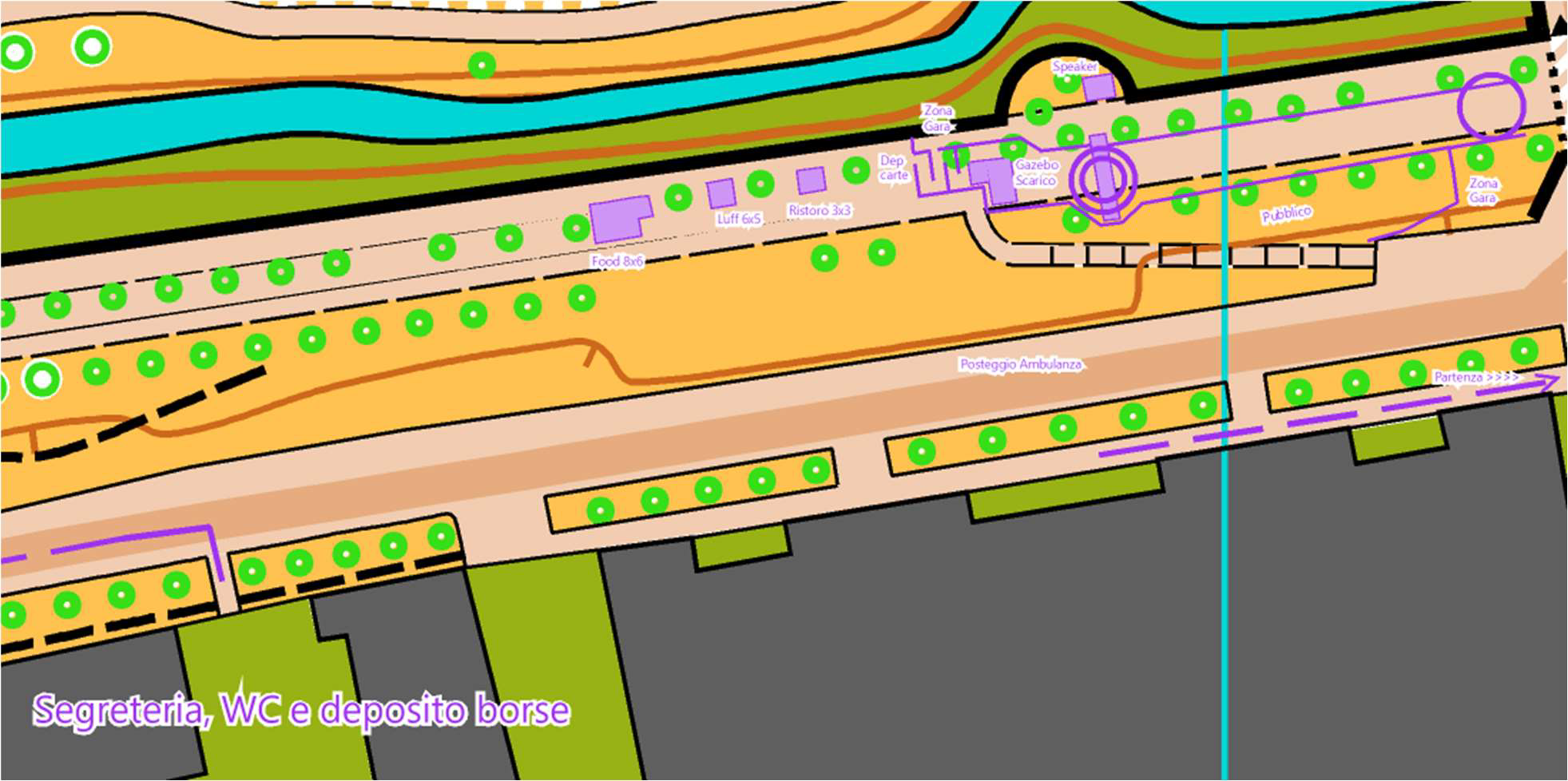
RACE ARENA
Herebelow there is the detailed map of the finish area and race arena.
MEETING POINT
You can leave your sport garments bag inside the gymn.
No surveillance available, no dressing room available.
TOILETS
Available inside the gymn. Showers not available.
SICARD/SIAC CODE NUMBER CHANGE
Must be communicated to entry office before your start time printed on your bib; it’s free of charge.
BIBS
Handed out in each club envelope. They show the number and start time of each athlete. They must be worn visibly without covering any part of them. Bibs are the same for the next day race in Cansiglio.
REFRESHMENT
Close to the finish with water and fresh fruit. Kindly avoid gatherings.
There will be a street food stand in the meeting area for the athletes and their companions.
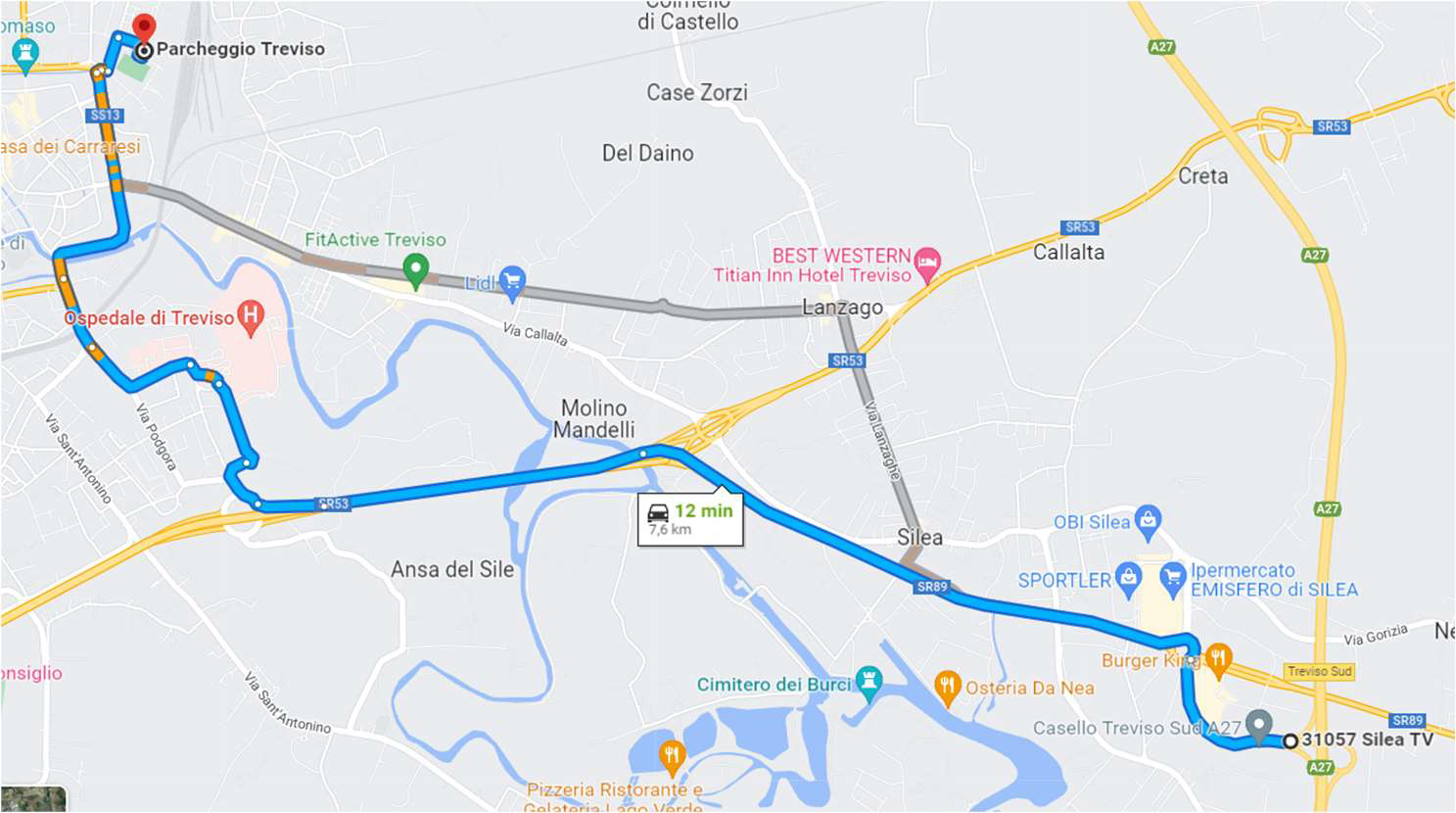
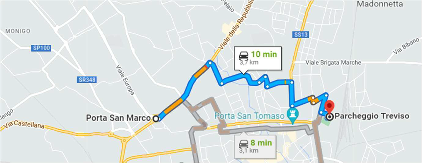
PARKING FOR MOTORHOME (CAMPER VANS)
For all those arriving by car or minibus we have highlighted in race bulletin n.1 the routes to the parking areas and then to the race arena.
Remember that the city centre and the ring of one-way streets surrounding the city walls are prohibited areas for the race.
Fot those arriving by motorhome (camper van), the nearest parking area is located near the stadium “Omobono Tenni”- geo-coordinates: 45.670028, 12.257889.
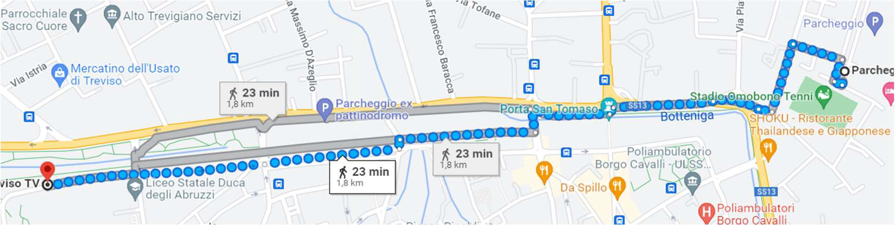
To reach the motorhome parking area, it is mandatory to follow herebelow map:
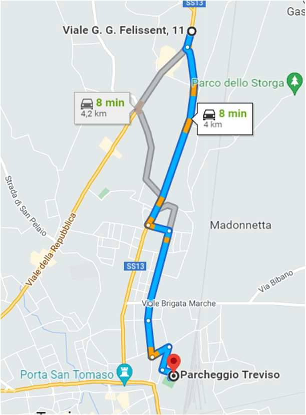
To reach the meeting point the are two options:
1) by bus n. 61 – bus stop is 10 minutes on foot far from parking – mandatory map due to prohibited zone (route evidenced in blue)
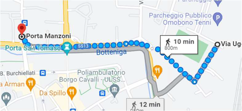
2) on foot – 20 minutes far from parking – mandatory map due to prohibited zone (route evidenced in blue)
These indications are mandatory since the ring road outside the walls of the city of Treviso is an embargated area.
START
-10 minutes on foot far from meeting area
-there will be two separate race corridors: 1 for the competitive categories and one for beginners / direct / W10 / M10
-delayed start – “K” point (i.e. triangle on the map) is 15 metres far from maps withdrawal.
TIMEKEEPING
Punch Type: Both Sport Ident and AIR+, even at finish point. Traditional punch can also be used. No SIAC rental available. Punch control code is only on checkpoints.
In case of non-functioning point, it is mandatory to punch it manually and show your map on arrival.
COURSE PLANS LENGTH
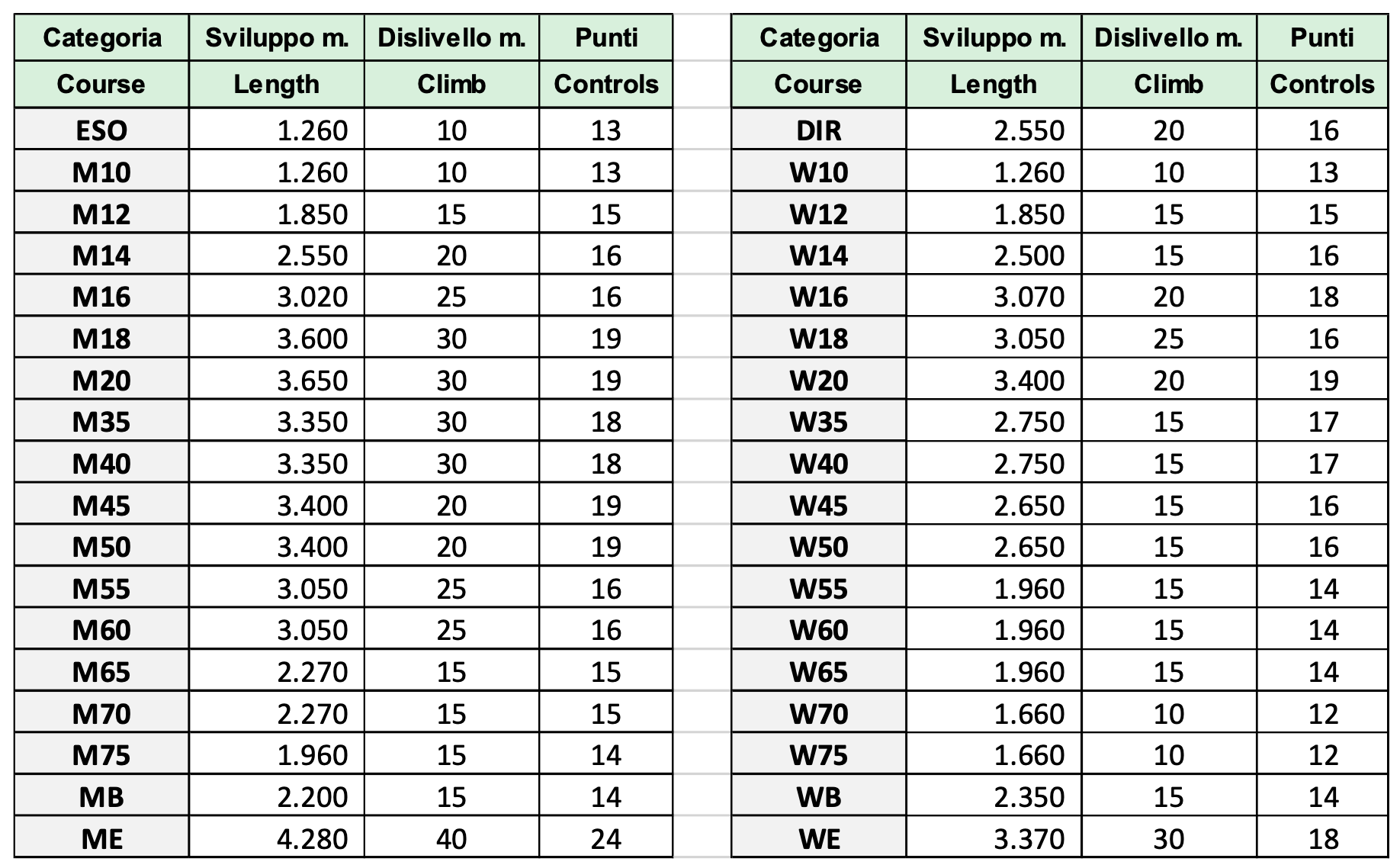
Map Size: cm. 22,5 x 32 – printed on blueback paper. In case of rain, plastic transparent envelopes will be available at the start.
At the end of the race, the maps must be put inside the bags of the respective clubs situated at the exit of the finish aisle.
Maximum race time: 60 min.
POINT DESCRIPTION
Punch points description is printed on the map itself which will be given to you at the start. A brief description of punch points is available at the start – corridor min “-2”.
No tapes and scissors are available.
The description will be textual for beginners / direct / W10 / M10. For all other categories it will be symbolic.
COURSE DESIGNER NOTES
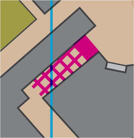
The town centre has several stalls, i.e. areas occupied by restaurants and places with tables and chairs. Please be careful, reconfirming that it is forbidden to cross these areas. They are marked on the map with the relevant symbol ISSprOM 714, as showN in in the example:
There are also some building renovations that in some cases impact in the space available for passageways, they are marked on the map with the relevant symbol ISSprOM 709, as shown in the example.
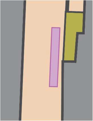
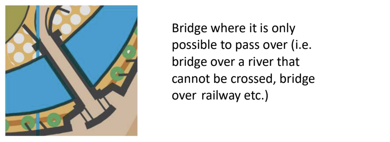
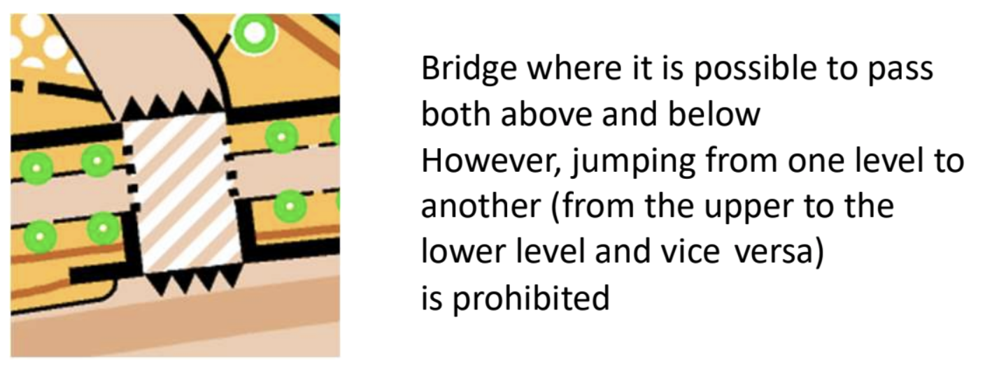
For most of the courses there are artificial barriers that cannot be crossed under penalty of disqualification. They are marked with the relevant combinations of symbols ISSprOM 708 and 709, as in the example shown here.
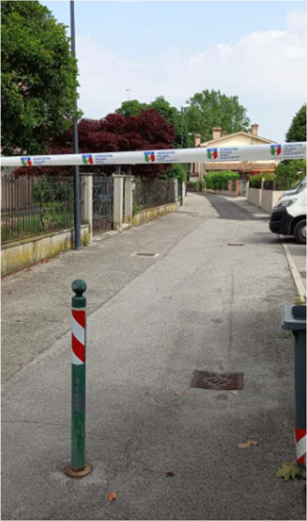
The barriers will be marked with FISO tape placed at a height of approx. 160/180 cm., similar to the following picture. The barriers will be manned by the organising staff.
Lastly, we highlight how some characteristic features of the city of Treviso, such as bridges, riverbanks and subways, have been shown on the map, according to ISSprOM symbolism.
We point out the presence of a wall that cannot be crossed, marked on the ground with the white / red tape which will be supervised by the organization.
SPECIAL OBJECTS
The map shows some special objects:
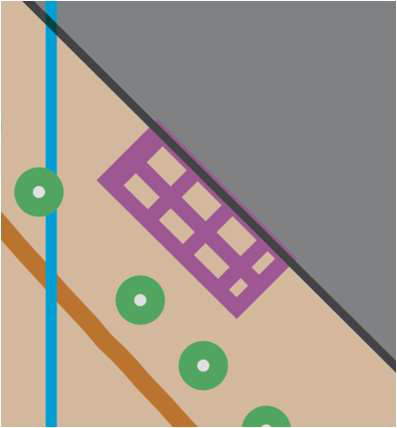
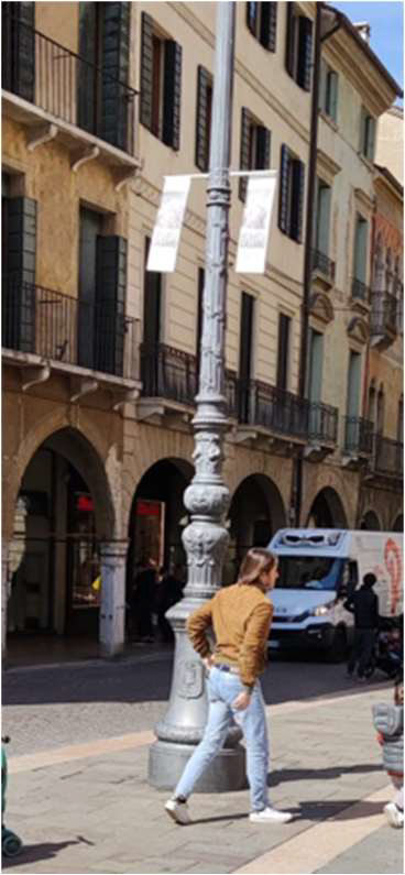
- The ISSprOM 530 symbol (the black dot) indicates children’s toys in parks and some clearly distinguishable “artistic and characteristic” light poles (as per self explanatory picture).
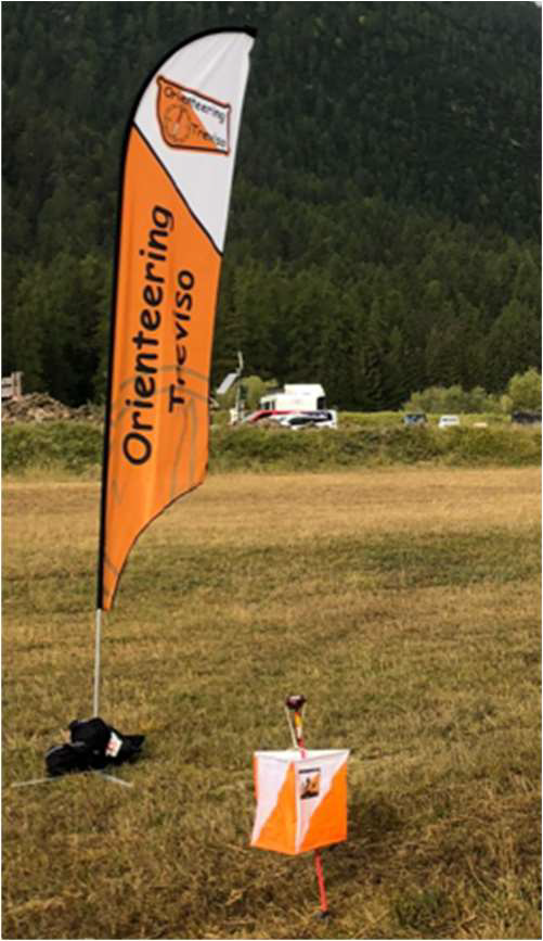
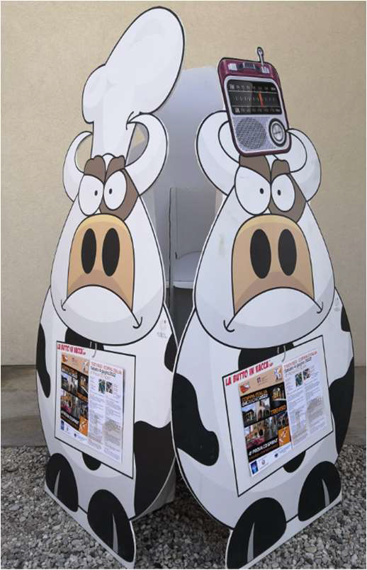
- The ISSprOM 531 symbol (the black X) indicates benches within the parks or special objects provided by the organisation and sponsors such as those shown below.
IMPORTANT
The race takes place in the historic centre of Treviso, in an area with limited vehicular traffic. The streets in the finish area are closed to the traffic.
The presence of several pedestrians and a few bicycles and cars in the streets and alleys of the city is to be expected, so care and respect for traffic rules is recommended.
Several members of our staff will man and facilitate the passage of the competitors.
Welcome in Treviso and enjoy your race!